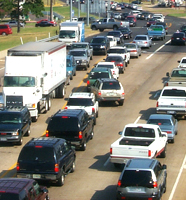
Traffic Count Maps and Tables
The Texarkana MPO is no longer conducting traffic counts. Traffic count information at locations within the Texarkana area is being obtained from traffic counts conducted by the Arkansas Department of Transportation (ARDOT) and the Texas Department of Transportation (TxDOT). The traffic counts and maps listed below on the MPO website are for historical information.
ArDOT Traffic Count Maps
Traffic counts can be found at this link. Click on the Maps on the right-side column. This will take you to the Maps section where various maps are found. Select State, County and City Annual Average Daily Traffic Maps. The Annual Average Daily Traffic Estimates page provides historical and current traffic estimates, a Web APP, maps, and a .zip file.
TxDOT Traffic Count Maps
The Texas Department of Transportation conducts traffic counts on an annual basis, for its 25 districts, along on-system (or TxDOT maintained) routes. Counts are collected every five years for off-system (or non-TxDOT maintained) routes.
These counts can be found at this link. The Texarkana Metropolitan Planning Organization study area (the Texas side) lies within TxDOT 's Atlanta District and can be found by following links to that district. Off-system counts for the Atlanta District were collected in 2013 [to be repeated in 2018]. These counts can be found under the heading "Urban Saturation Maps" by selecting the corresponding year and following links to the Atlanta District. For consistency TxDOT collects counts up to a mile and a half into the Arkansas portion of the MPO study area.
MPO Maps
Beginning with 2013 the MPO will resume producing one large scale map, in a .pdf format, that includes traffic counts for the entire study area, to be released later this year (2015) and published to this web page. Any person interested in a finer grained, smaller format, map can contact the Transportation Planner or email txkmpo@txkusa.org and we will attempt to accommodate your request.
Traffic count information listed below is presented as a series of maps and tables with links to the actual maps and tables shown in blue. Maps and tables are formatted as Abode Acrobat documents (pdf). The traffic counts are not vehicle counts. When conducting traffic counts, a tube is placed across the roadway and when a vehicle crosses the tube, the number of axle hits are counted. The computer divides the total number of axle hits by two. If ten 2-axle cars cross the tube, the computer counts 20 hits and divides by 2 for a count of 10. In this case, the count of 10 also represents ten vehicles. However, if ten tractor-trailer trunks with 5-axles per truck cross the tube, the computer would register 50 hits and divide by 2 for a count of 25 even though the number of vehicles was actually 10 trucks.
2015 traffic count map(pdf)
' . $file . ' traffic count map(pdf)';
$missingMap=false;
for ( $i = 1; $i <= 24; $i += 1) {
if (!file_exists($pathToMaps . '/' . $file . '/section' . $i . '.pdf' )) {
$missingMap=true;
}
}
if (!$missingMap) {
$mapArr[$file] .= ' ' . $file . ' Sectioned Map';
}
if (file_exists($pathToMaps . '/' . $file . '/' . 'legend.pdf')) {
$mapArr[$file] .= ' ' . $file . ' Legend(pdf)
';
}
else {
$mapArr[$file] .= "
";
}
}
}
}
closedir($handle);
}
arsort($mapArr);
foreach ($mapArr as $value) {
echo $value;
}
?>
The traffic count location map(pdf) shows the site identification number for each of the selected traffic count locations that can be used to obtain historical traffic count data from the tables presented below. This map measures 34 inches by 44 inches. The traffic count location map has been divided into 24 sections so each section can be printed on an 8 inch by 11 inch page. Click on the traffic count location sectioned map(pdf) to access the 24 sections of the map and then click on the particular section you want to see or print.
Tables
Traffic count information presented in tables can be printed on legal size paper (8" by 14"). Three traffic count tables are presented for each year based on the Site ID, the state number of the roadway and the local name of the roadway.
| ' . $file . ' | Site ID Table | State Number Table | Local Name Table | '; } } } closedir($handle); } arsort($tableArr); foreach ($tableArr as $value) { echo $value; } ?>